The quick version
- Madeira is the summit of a volcano that rose from the ocean floor, and the west coast shows its basalt layers, dykes and old lava flows in the road cuttings.
- The Paúl da Serra is the island's high table, a windswept upland of peat, ponds and low shrubs where the clouds often sit and the air is cooler than the coast.
- At Porto Moniz the sea fills basins in old lava; the complex has a swimming area of 3,800 m2 that is 2 metres deep and holds around 7,600 m3 of seawater.[1]
- Cabo Girão stands 580 metres high above the south coast[2], and the laurissilva forest behind the north coast has been a UNESCO World Heritage Site since 1999[3].
- A 4WD day from Funchal links the Cabo Girão Skywalk, Seixal, Porto Moniz and Fanal in 8 hours, with pickup included.[4]
- Top choice Skywalk, Seixal & Fanal 4WD from US$79 Rated4.87 from 9,297 reviews[4]Duration8 hours[4]Group sizePrivate or small groups[4]Guide languagesPortuguese, Spanish, English, French[4]CancellationFree up to 24 hours in advance[4] Check availability
- Terraces, Moniz & Fanal 4WD from US$80 Rated4.78 from 5,647 reviews[5]Duration8 hours[5]Group sizePrivate or small groups[5]Guide languagesSpanish, English, French, Portuguese, German[5]CancellationFree up to 24 hours in advance[5] See this tour
- Waterfalls & Fanal Forest from US$40 Rated4.70 from 3,827 reviews[6]Duration8 hours[6]Group sizePrivate or small groups[6]Guide languagesGerman, Spanish, English, Portuguese, French[6]CancellationFree up to 24 hours in advance[6] See this tour
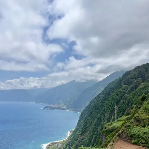
At 580 metres high, Cabo Girão is the highest promontory in Europe, but this is not the only reason it has become increasingly famous all over the world.
Worth it if you want the island's geology in one day
Planning your west coast day
On the day
A volcanic island built from the ocean floor
Madeira is the summit of a volcano that grew from the ocean floor, and almost everything you pass on the west coast belongs to that single long story. Basalt, ash, dykes and old lava tongues stack up in the road cuttings between Ribeira Brava and São Vicente, tilted and sliced by erosion. The high plateau, the sea cliffs and the shoreline are the same material seen at different heights, which is why a drive across the island can feel like walking through a cross section of the mountain that made it. Nothing here has ever settled down for long.
The west is where that story is easiest to read in a single day. Madeira's laurissilva forest has been a UNESCO World Heritage Site since 1999[3], and the same forest falls down the north slopes above Seixal and Porto Moniz. At Fanal, the island's tourism board invites visitors to come and contemplate what it describes as a mystical century old forest[3]. Between the plateau and the sea the ground drops away quickly, so the whole sequence of rock, soil, forest and coast passes your window in one drive.
Reading the rocks in the road cuttings
You do not need a geology degree to follow what happened here. Look at any fresh cutting and you will see stacked dark bands, some thick and blocky, some crumbly and pale, with paler seams running across them at an angle. The flat layers are old lava flows and ash beds laid down one after another, sometimes with a red band where the top of a flow baked in the open air. The seams that cut across everything are dykes, places where later molten rock pushed up through rock that had already cooled. The road builders have done the excavating for you.
The same story is still being written overhead. Madeira has a subtropical Mediterranean climate with even temperatures all year round and an average annual temperature of 20°C (67°F)[7], which means rain and cloud work on the rock constantly. Water finds cracks, widens them through the winter, and plants move in behind. That combination of wet air and steep ground is what turns hard lava into the soft, green, rounded ridges you look down on from the plateau road. On the north side, where cloud sits longer, rock is hidden under forest almost everywhere.
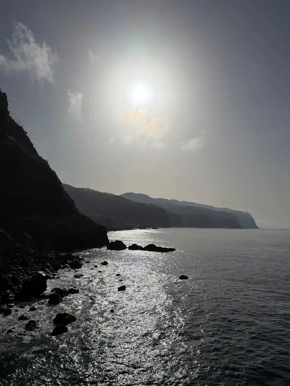
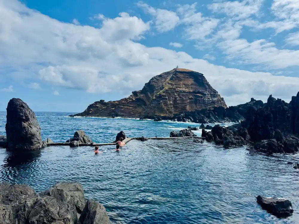
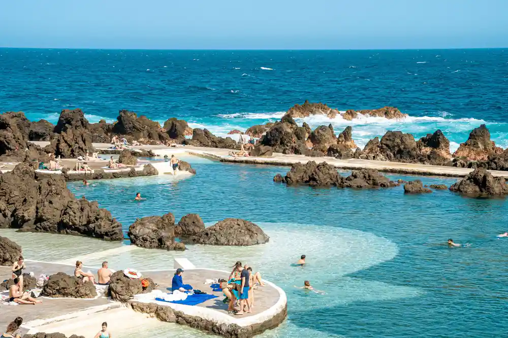
Lava basins on Madeira's north coast, refilled by the Atlantic at every tide.
The Paúl da Serra plateau: lava's high table
Climb out of the south coast villages and the road suddenly levels off onto the Paúl da Serra, a high table of peat, ponds and low shrubs that can feel like a different island. It is open country by Madeira standards, and a useful reminder that a volcano is not always a cone. Lava that poured out in thin sheets and never built a peak spread sideways instead, and a very long stretch of erosion has shaved the top into the broad upland you cross today. Sheep, wind and cloud are the main company up there.
The plateau has its own weather. Cloud catches on the high ground, wind runs across it, and the air is noticeably cooler than on the coast only a few minutes below. Walkers and cyclists appear out of the mist with little warning, and the views open and close again within minutes of driving. Standing there, it is easier to picture Madeira as a wide dome of stacked lava flows than as a single peak rising out of the sea.
How lava created the Porto Moniz rock pools
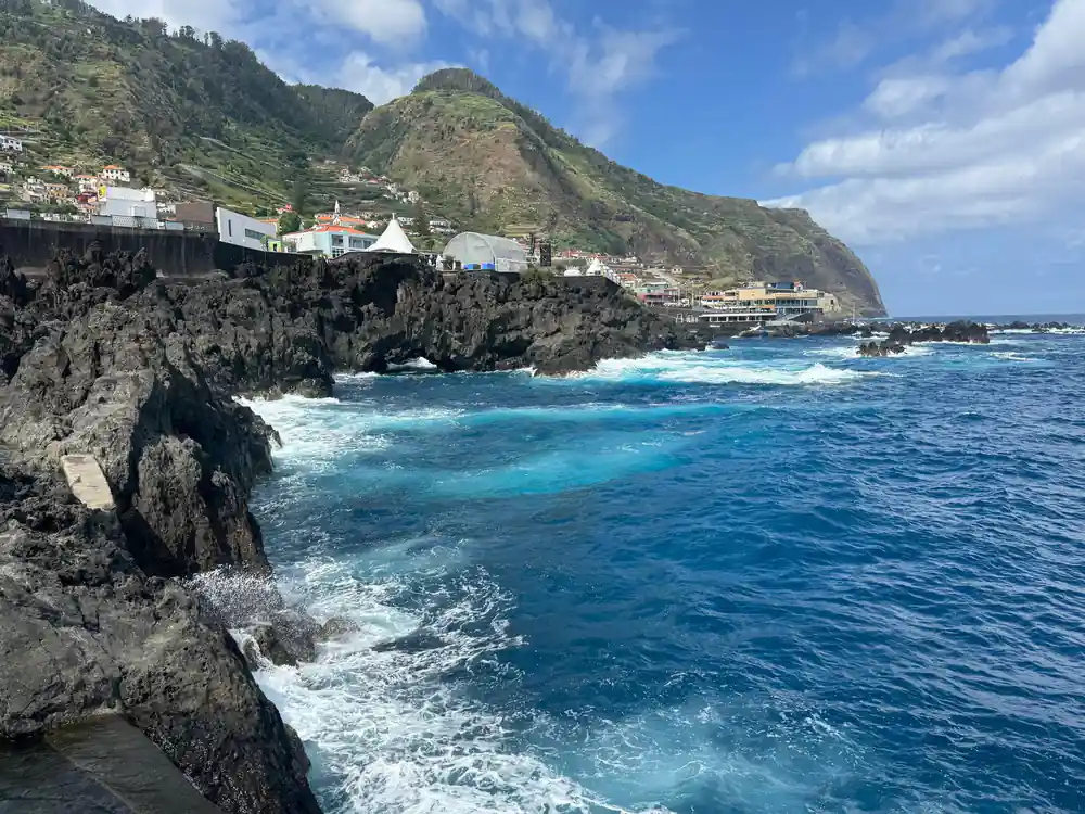
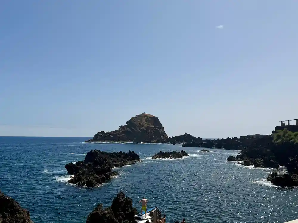
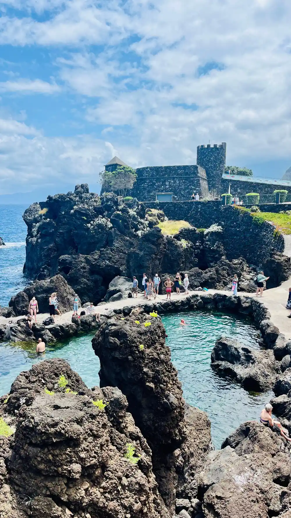
The pools at Porto Moniz show lava and sea working together on a scale that is easy to see. Old flows reached the water and cooled into dark, cracked rock. The Atlantic then quarried away the weaker parts over a very long time, leaving basins that fill over the rim at high water and drain again as the tide falls. The municipality describes a swimming area of 3,800 m2 that is 2 metres deep and takes in around 7,600 m3 of seawater, with a lounging area of approximately 3,217 m2 beside it[1].
Swimming there is a strange pleasure, half sea and half pool, with the swell arriving over the rim and salt drying on hot black stone. Because the ocean decides the conditions, the basins can be shut when the swell is big, so treat a swim as a bonus rather than a promise. Further along the same north coast at Seixal there are smaller pools of the same kind, usually quieter, and most drivers heading west pass them without stopping.
from US$79
Skywalk, Porto Moniz, Seixal and Fanal by 4WD: 8 hours, pickup included, live guide and free cancellation up to 24 hours.[4]
Coastal cliffs and the Fanal laurisilva forest
The south coast finishes in the great cliff at Cabo Girão, which stands 580 metres high[2] approximately 15 kilometres west of Funchal[8]. The skywalk platform on top was completed in October 2012[9], and it is a fine place to appreciate what a volcanic coastline looks like from directly above. Below the cliff, the narrow shelf of farmland at Fajã do Cabo Girão is known for the impressive fertility of its land and is reached by cable car[10].
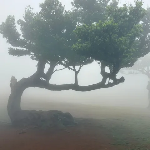
North of the ridge the character changes completely. The laurissilva forest has been a UNESCO World Heritage Site since 1999[3], and Fanal is one of the places Madeira's tourism board invites visitors to discover, describing it as a mystical century old forest[3]. The trees there stand in open, mossy ground, shaped by wind and mist, and on a still morning the place has an atmosphere photographs rarely capture. It is also the coolest stop on most west coast days, so keep a layer within reach.
Seixal's black sand and volcanic beaches
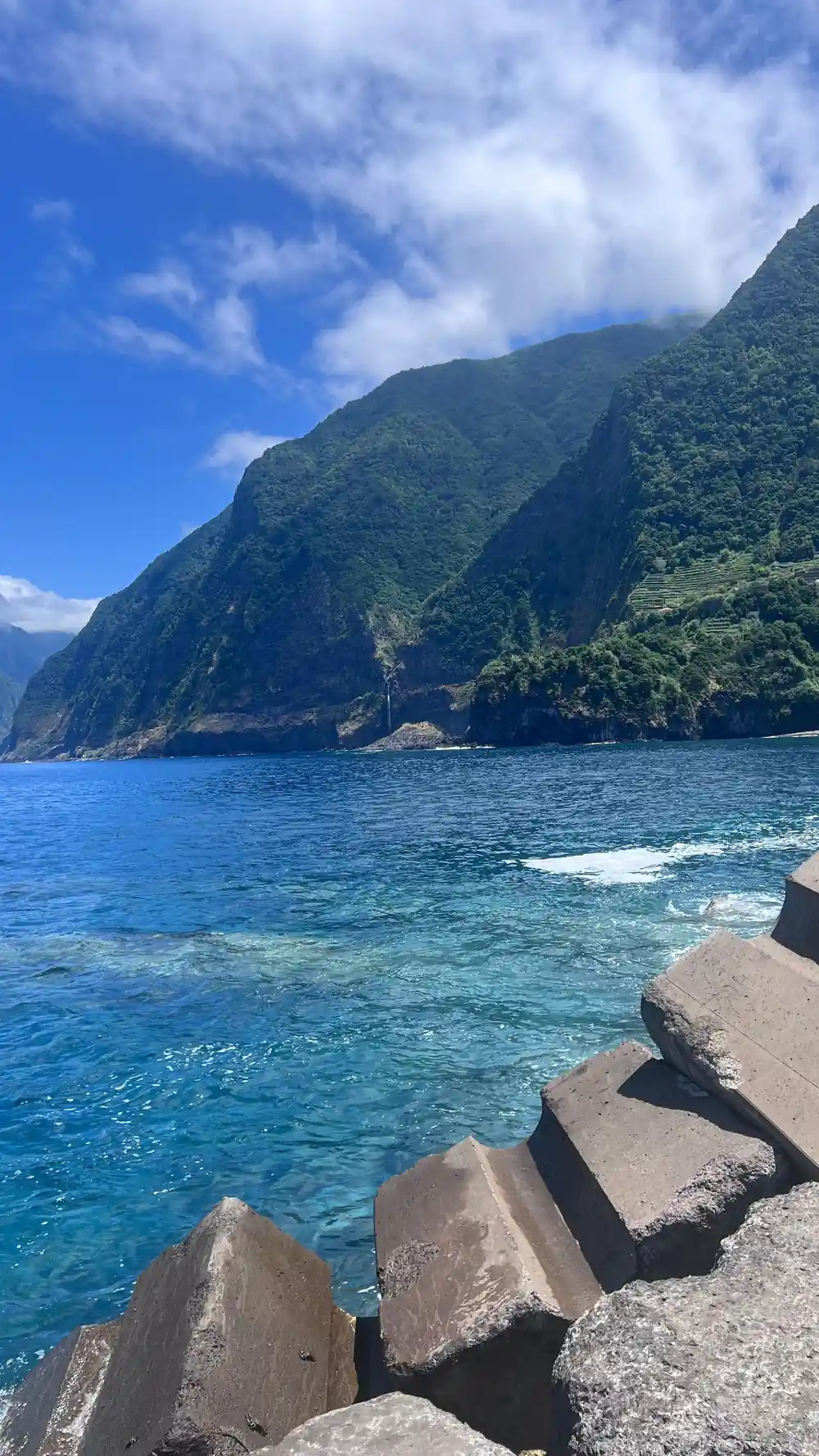
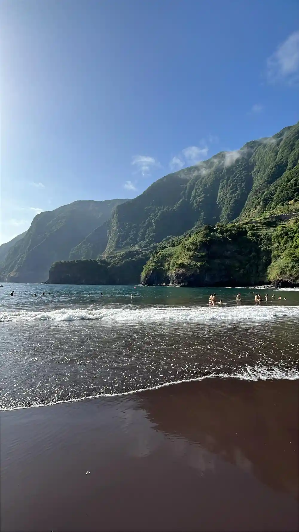
Seixal's beach is dark, almost black, because the sand is volcanic rock ground down by the Atlantic rather than the pale shell and coral sand of warmer islands further south. The shore break on the north coast is powerful and largely unpatrolled, so it is a place for walking, paddling and photographs more than for long swims. The village sits under green cliffs, with waterfalls after rain and natural pools a short walk from the sand.
Further east along the north coast, the Guindaste Viewpoint sits on one of the slopes of the Foz da Ribeira do Faial in the municipality of Santana and offers a view over the north coast of the island[11]. Head back south and the same dark rock reappears in the pools at Porto Moniz and in the black pebbles of the south coast beaches. Dark sand, dark cliffs and dark pools are all cooled lava, seen at very different scales.
Island steepness: why Madeira feels vertical
Madeira has almost no flat land. From the plateau the ground falls away on both sides towards the sea, and the roads answer with hairpins, tunnels and viaducts, one after another. That steepness is volcanic in origin: a dome of stacked flows, cut for a very long time by streams running straight down to the coast. Walking a levada gives you the same sense at a slower pace, and the Levada do Norte walk runs from Estreito de Câmara de Lobos to Cabo Girão[12].
For travellers, the verticality is the main practical point. A short distance on the map can take a long time in the car, and the west coast is best treated as a full day out rather than squeezed between other plans. Layers, grippy shoes and a relaxed attitude to cloud will make almost any day better, and a driver who knows the tunnels and the small viewpoint car parks is worth more than a long list of stops.
Hours on the road: west Madeira day tours
Durations as stated on the GetYourGuide listings:[4][5][6][13][14]
What a west coast day costs
From-prices per person shown on the GetYourGuide listings for these west coast tours.[4][5][6][13]
When to go and when to book
Planning the west coast
Pick your base
Most west coast tours start in Funchal, with pickups along the south coast and in Câmara de Lobos.
Choose the vehicle
A jeep handles the plateau tracks and the north coast hairpins better than a coach, and it reaches the small stopping points.
Hold your place
Reserve now and pay later is offered on the Skywalk, Porto Moniz, Seixal and Fanal 4WD tour, so you can book early.[4]
Pack for two climates
Coast and plateau can feel like different seasons on the same afternoon, so bring a warm layer and a light rain shell.
Ask about the pools
Sea conditions decide whether the natural pools are open for swimming, so ask your guide on the morning of the trip.
See the volcanic west coast with a local driver
from US$80Reserve now & pay later